UPDATE: More Severe Storms Expected Across Illinois

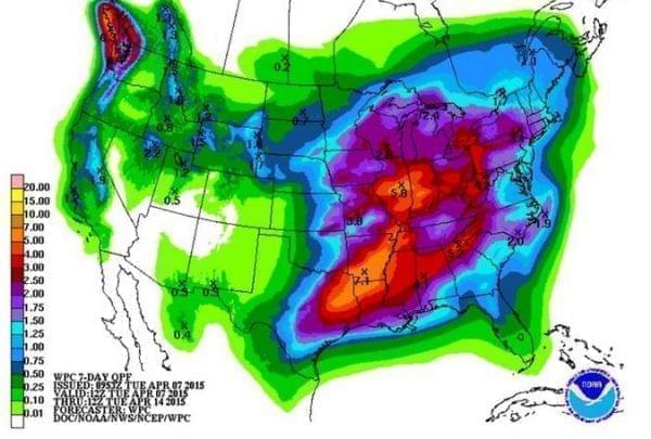
The National Weather Service has warned of the potential for severe weather across Illinois over the next few days. That includes a chance of severe storms, damaging winds, even tornadoes this afternoon. (Photo: NOAA)
The National Weather Service has issued a tornado watch until 11pm Thursday for most of Central Illinois.
|
FORECAST |
Jeff Frame is with the University of Illinois' atmospheric sciences department. He says clear skies and warmer temperatures to the west drove the formation of storms earlier today that will start to move into the listening area Thursday evening.
"The worst of the weather probably coming in here 7, 8, 9 maybe lingering to 10 o'clock. Near and just after dark really be paying attention." He says.
"There's a chance of something rogue going out ahead of this a little earlier. But focusing in on that evening time frame is when we have the best chance of seeing severe weather."
Once this system passes, Frame says the weather will settle down through the weekend.
The outlook from the National Weather Service shows the next chance of severe storms comes early next week.
"The state of the science is not that we can say a tornado will hit this county or this town at this time," said Frame,
"What we can say is there is an enhanced risk of tornadoes from mid to late afternoon and into this evening."
WILL will broadcast weather updates throughout the day.
